The South African Weather Service says freezing temperatures are expected to persist across parts of the country. Temperatures are plummeting, with the cold front bringing disruptive snowfall in some areas.
SA Weather Service Forecaster, Lulama Pheme says, “We are still expecting snowfall, with disruptive snowfall over the southern Drakensburg and the western parts of KZN right up to Newcastle. That is where we are expecting disruptive snowfall for today.”
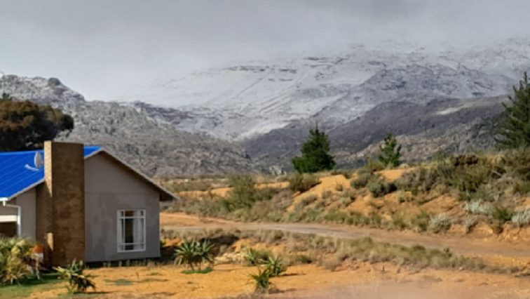
Snow continues to fall over high lying areas of the Western Cape as a cold front sweeps through the province.
Icy conditions are being experienced in the province with temperatures plummeting to between 0 and 3 degrees in places.
Snow has been recorded in the mountains at Ceres, at the Matroosberg Nature Reserve, in Jonkershoek in Stellenbosch, in the Cederberg and in the mountains at Franschoek and in Worcester.
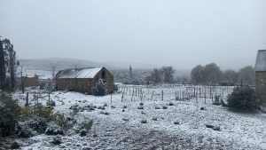
Winter wonderland
On Sunday, the town of Ceres turned into a winter wonderland with significant snowfall on the mountains. Owner of the Matroosberg Nature Reserve, Didi de Kock says residents and holidaymakers are flocking to the town that is experiencing typical cloudy, cold and misty winter weather.
“We had some rain that washed away some of the show, but in the mountain there is still a lot of snow, so the people that can park at the camp site and walk about 500 metres they will still reach good snow. If it’s your first time show hunting, this is not a bad opportunity, if you’ve seen nice beautiful thick snow then maybe hang on for a bit later in the season.”
Eastern Cape
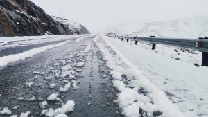
Snow has fallen overnight in parts of the Eastern Cape. Drivers have been warned to be cautious at the Penhoek pass on the N6, between Komani and Jamestown.
There are also reports of snow in the Hogsback area.
The Weather Service has forecast that Monday will be the coldest of the current cold front. Spokesperson Isaac Mangena says cold temperatures would lead to higher electricity demand, putting pressure on its network. Despite the chilly conditions, the UVB sunburn index remains high.
A cold front will cause a significant drop in temperatures over Gauteng on Monday. Maximum temperatures are expected to be between O9 Degrees Celsius and 13 Degrees Celsius.
VIDEO: SA Weather Report
-Reporting by Berenice Moss, Sarel Mentjies and Olwethu Matsipane.