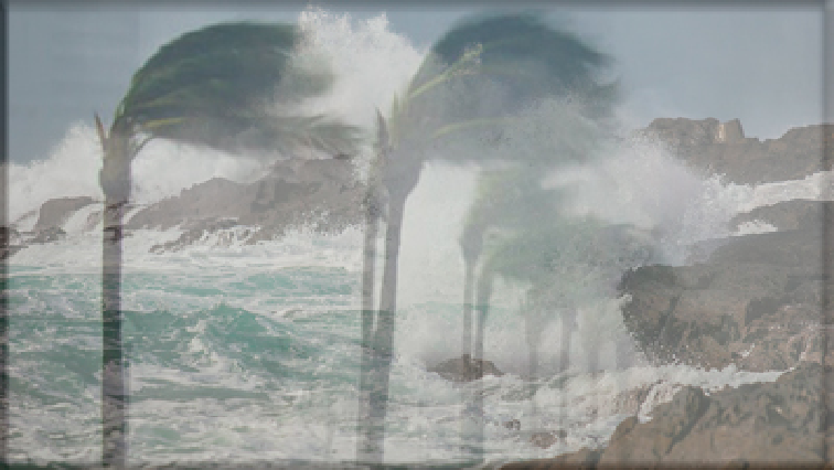
The South African Weather Service has warned Capetonians to brace themselves for strong winds and heavy rainfall as two cold fronts approach the Mother City.
The storm is expected to make landfall on Monday night or early on Tuesday morning with heavy rainfall of up to 50 millimetres expected in some areas. This may lead to mudslides.
The cold windy weather is expected to persist until Wednesday.
The City’s Disaster Risk Management spokesperson, Charlotte Powell, says officials will be on high alert as wind speeds are expected to reach between 65 and 75 kilometre per hour.
“Very rough seas with waves in excess of 6 meters are predicted for the coastal areas. Members of the public are urged to stay away from areas like the Atlantic Seaboard, False Bay coastline and Strand, Gordon’s Bay beachfront during this period. Property owners along the coast need to be prepared for possible storm surge impacts to their property,” says Powell.
Increase in dam levels
Meanwhile, the Western Cape Department of Local Government and Environmental Affairs says the extreme weather across the province has led to an increase in dam levels.
The latest average level for dams across the province is 49,6%, while the City of Cape Town’s dams have reached an average level of 63,8%.
Department spokesperson, James Brent-Styan, says disaster management teams and emergency services units are on standby.
“We want to urge people to use extreme caution, to limit the amount of time they spend outdoors, to consider the risks to livestock and other animals as well. And also when travelling around outdoors road surfaces are expected to be more dangerous due to icy conditions in many areas around the province. Please do note the emergency number 112 in the case of any assistance that’s necessary.”