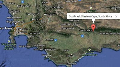
Suurbraak is a settlement in Overberg District Municipality in the Western Cape. It lies in a fold of the Langeberg Mountains just down from the incredible Tradouw Pass.
Suurbraak lies in what could easily be termed a little piece of heaven, and because it is not a commercial centre is left largely alone.
The village was established in 1812, when the London Missionary Society established a mission station to serve the Attaqua Khoikhoi.
People still cook on wood burning stoves, use donkey-drawn ploughs and horses and carts to get around – it’s really old-style living, mostly untouched by development.
The local community is rather starved of sources of income.
The heart of the village of Suurbraak has been preserved, and the buildings that rest on the village square and the two church buildings have been restored.
Most of the old style houses line the road through town, and if you want to explore, it is a wonderful place to visit and from which to walk – the Wonder Kloof lies across from town, an incredible geological crack in the Langeberg Mountain range, with a number of recently opened hiking trails that take you through the kloof.
Suurbraak was known as Xairy, meaning paradise, by the Quena tribe of the Khoi who were the original inhabitants.
Hiking and biking and visiting historical buildings are the main attractions of the town.
It has a population of about 2 252 people, with the majority being the Afrikaans-speaking people
Town: Suurbraak
City: Cape Town
Municipality: Swellendam Local Municipality / Overberg District Municipality
Population: 2 252
Swellendam Local Municipality
Swellendam was founded in 1747 when the Drostdy was built to house the landdrost (magistrate). For a momentous few months in 1795, it was one of the capitals of the world. Angered by the misrule of the Dutch East India Company, its handful of citizens dismissed their magistrate, declared a republic and appointed a president. Three months later the British took over the Cape and the little republic passed into history.
By the 1850s, British settlers had colonised the eastern parts of the municipal area, and Swellendam prospered as a replenishment stop. Boats laden with provisions were sent via Malgas down the Breede River to the ships waiting near Infanta harbour.
Suurbraak was known as Xairy, meaning paradise, by the Quena tribe of the Khoi who were the original inhabitants. Established as a mission station by the London Missionary Society, it was later taken over by the Algemeende Sendings Kerk.
The farming community of Barrydale, which was in existence by 1832, is situated inland of the Langeberg Mountains.
Swellendam was named after Governor Swellengrebel and his wife Helena Ten Damme.
Employment by Industry (% of Labour force)
Agriculture ……………………………………………….. 1,402 (8.8%)
Mining / quarrying ……………………………………………. 0 (0.0%)
Manufacturing ………………………………………….. 1,109 (6.9%)
Electricity / gas / water supply ……………………….. 105 (0.7%)
Construction …………………………………………………..775 (4.9%)
Wholesale / retail trade …………………………………..1,443 (9.0%)
Transport / storage / communication ………………. 312 (2.0%)
Financial / insurance / real estate ……………………. 540 (2.3%)
Community / social / personal services …………. 1,181 (7.4%)
Private households / other ………………………… 4,247 (17.7%)
Population by Monthly Income (incl Social Grants) (% of population)
R 204 801 or more ………………………………………….. 0 (0.0%)
R 102 401 – R 204 800 ……………………………………. 0 (0.0%)
R 51 201 – R 102 400 ……………………………………. 51 (0.2%)
R 25 601 – R 51 200 ……………………………………. 157 (0.7%)
R 12 801 – R 25 600 ……………………………………. 425 (1.8%)
R 6 401 – R 12 800 ……………………………………… 878 (3.7%)
R 3 201 – R 6 400 …………………………………….. 1,332 (5.5%)
R 1 601 – R 3 200 …………………………………… 3,051 (12.7%)
R 801 – R 1 600 ……………………………………… 6,309 (26.2%)
R 401 – R 800 ………………………………………….. 1,605 (6.7%)
R 1 – R 400 ……………………………………………… 1,465 (6.1%)
No income …………………………………………….. 6,370 (26.5%)
– By